TEAL TECHNOLOGY

From observation to ecological intelligence.

From observation to ecological intelligence.

From observation to ecological intelligence.

OBSERVE

What existing sources cannot.

→

↓

↓

INTEGRATE

Ground observations with existing data.

→

↓

↓

UNDERSTAND

Build richer ecological datasets.

We are starting with the ground beneath us.

We are starting with the ground beneath us.

We are starting with the ground beneath us.

TEAL's first observation system brings continuous, multi-depth sensing directly into the soil

TEAL’s first observation system brings continuous, multi-depth sensing directly into the soil

TEAL’s first observation system brings continuous, multi-depth sensing directly into the soil

Built for continuous observation in the field.

Built for continuous observation in the field.

Built for continuous observation in the field.

Multi-depth sensing · Low-power operation · Satellite connectivity · Autonomous deployment

Multi-depth sensing · Low-power operation · Satellite connectivity · Autonomous deployment

Multi-depth sensing · Low-power operation · Satellite connectivity · Autonomous deployment

Concept sensor shown. Actual sensor design may vary.

Concept sensor shown. Actual sensor design may vary.

OBSERVATION OPTIMIZATION

Better observations start with knowing where you measure.

Better observations start with knowing where you measure.

Better observations start with knowing where you measure.

TEAL determines where sensors should be deployed to maximize ecological information while balancing coverage, environmental variability, installation, and maintenance.

TEAL determines where sensors should be deployed to maximize ecological information while balancing coverage, environmental variability, installation, and maintenance.

TEAL determines where sensors should be deployed to maximize ecological information while balancing coverage, environmental variability, installation, and maintenance.

Terrain

Microclimates

Required coverage

Maintenance

Installation cost

Operational status changes across the terrain as coverage, access, and maintenance constraints update.

DATA FUSION

Integrating observations into richer ecological datasets.

TEAL combines existing environmental data, client information, and proprietary observations to create more precise, contextual ecological datasets.

Markets that need more precise datasets

Markets that need more precise datasets

As those sources are integrated, proprietary ecological datasets become the foundation for applied tools, decision support, and future intelligence systems.

As those sources are integrated, proprietary ecological datasets become the foundation for applied tools, decision support, and future intelligence systems.

As those sources are integrated, proprietary ecological datasets become the foundation for applied tools, decision support, and future intelligence systems.

Proprietary datasets → expanding applications

Proprietary datasets → expanding applications

Proprietary datasets → expanding applications

TODAY

TODAY

Precision Agriculture
Carbon MRV
Carbon Project Development
Land & Soil Management

Precision Agriculture
Carbon MRV
Carbon Project Development
Land & Soil Management

EXPANDING

EXPANDING

Infrastructure Planning
Wildfire Risk
Flood & Drought Risk
Insurance & Underwriting
Nature-Based Asset Valuation

Infrastructure Planning
Wildfire Risk
Flood & Drought Risk
Insurance & Underwriting
Nature-Based Asset Valuation

FUTURE

FUTURE

Data-as-a-Service
Integrated Ecological AI
Ecological World Models
Predictive Ecosystem Intelligence

Data-as-a-Service
Integrated Ecological AI
Ecological World Models
Predictive Ecosystem Intelligence

As those sources are integrated, proprietary ecological datasets become the foundation for applied tools, decision support, and future intelligence systems.

Proprietary datasets → expanding applications

EXISTING ENVIRONMENTAL DATA

Remote sensing · climate · government · research

+

CLIENT + SITE DATA

Operational · proprietary · local

+
TEAL OBSERVATIONS

Ground · continuous · multi-depth

fuses into

PROPRIETARY DATASETS

Higher granularity · higher precision · contextual

DATA INTEGRATION DEMO

Mapping carbon credit sites from integrated ecological data.

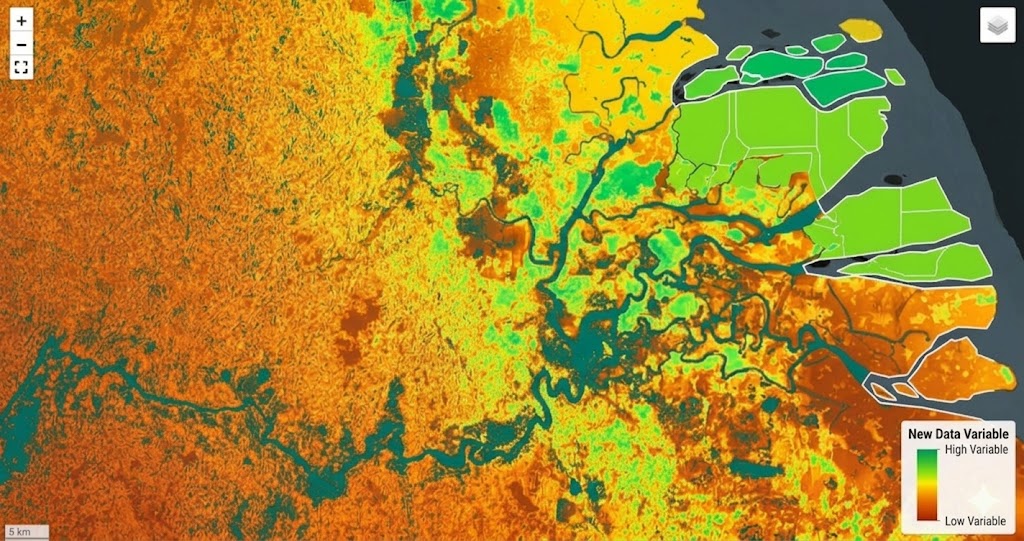
This demo shows how environmental layers, site analysis, and dashboard workflows can come together to evaluate carbon credit opportunities. The same infrastructure can support broader applications across land management, risk, agriculture, MRV, and ecological intelligence.

This demo shows how environmental layers, site analysis, and dashboard workflows can come together to evaluate carbon credit opportunities. The same infrastructure can support broader applications across land management, risk, agriculture, MRV, and ecological intelligence.

This demo shows how environmental layers, site analysis, and dashboard workflows can come together to evaluate carbon credit opportunities. The same infrastructure can support broader applications across land management, risk, agriculture, MRV, and ecological intelligence.

Data integration

Site analysis

Carbon credit mapping

Decision dashboard

Designed by TEAL

2026